Remote Sensing Specialist
Transforming satellite data into actionable insights for hydrographic and environmental applications at the Danish Geodata Agency.

Transforming satellite data into actionable insights for hydrographic and environmental applications at the Danish Geodata Agency.
Specialized in remote sensing applications and hydrographic data processing
Advanced processing of Sentinel-2 and WorldView imagery for environmental monitoring and navigation hazard detection in complex water systems.
Depth model integration, satellite-derived bathymetry, and open channel hydraulics analysis for marine and freshwater environments.
Custom tools, QGIS plugins, and automated workflows for hydrographic data processing and geospatial analysis.
Innovative solutions bridging technology and environmental science
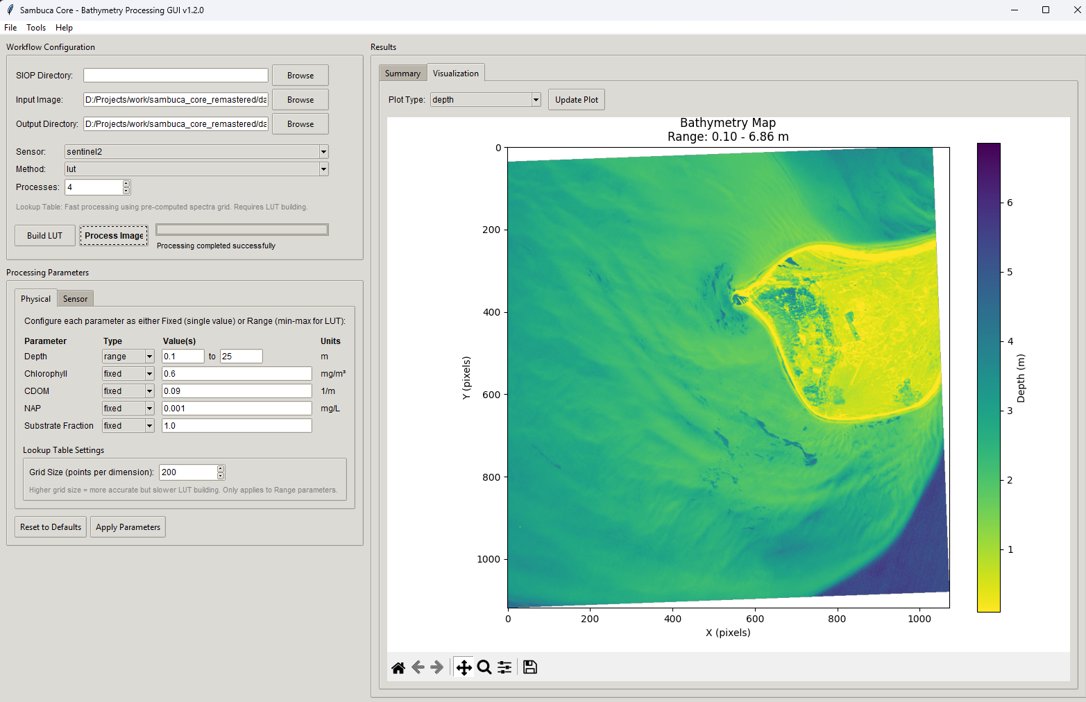
Graphical interface for CSIRO's bathymetric model
Graphical interface for CSIRO's Semi-Analytical Model for Bathymetry, Unmixing and Concentration Assessment, enabling advanced water column analysis and bathymetric modeling.

Automated coastal monitoring using satellite imagery
Automated coastal monitoring system using satellite imagery to detect and quantify dune and shoreline changes over time for environmental assessment.
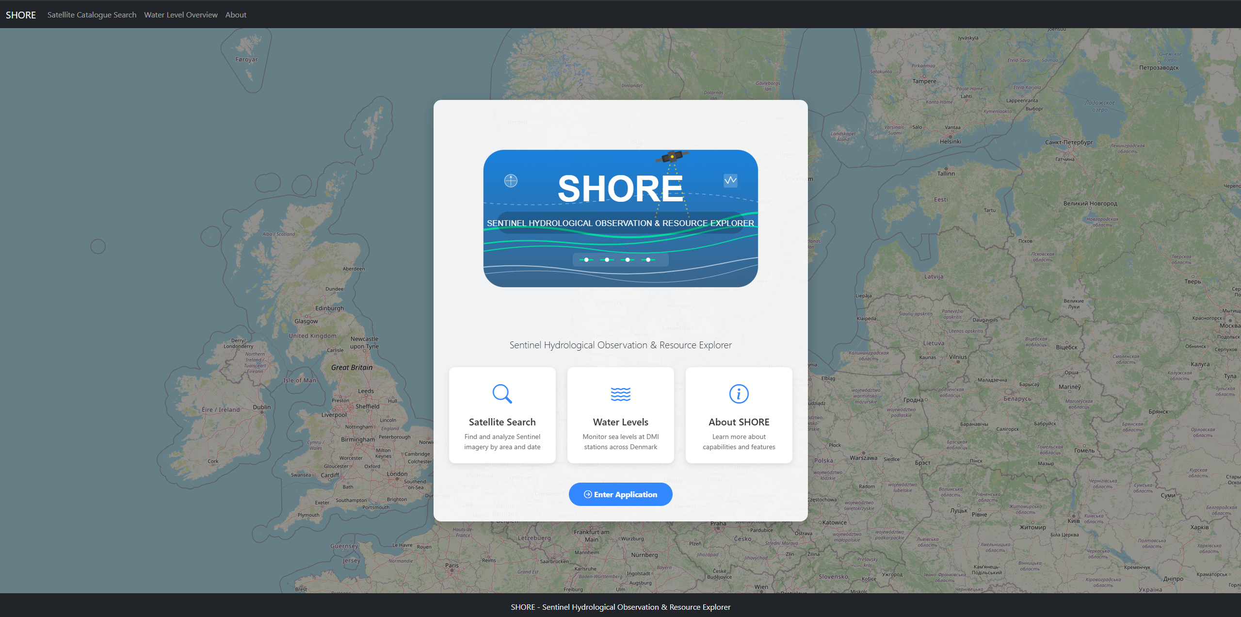
Sentinel Hydrological Observation & Resource Explorer
Sentinel Hydrological Observation & Resource Explorer - integrated platform for satellite imagery search with real-time water level data from DMI.
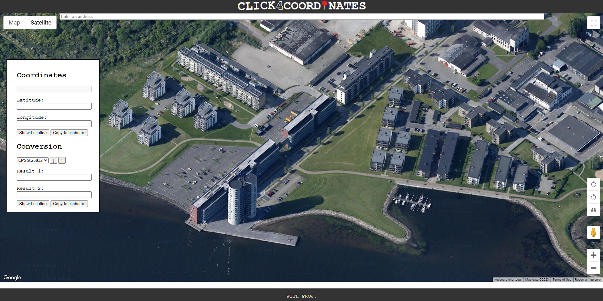
Web-based coordinate collection with UTM detection
Web-based coordinate collection tool with automatic UTM zone detection and comprehensive coordinate transformation capabilities.
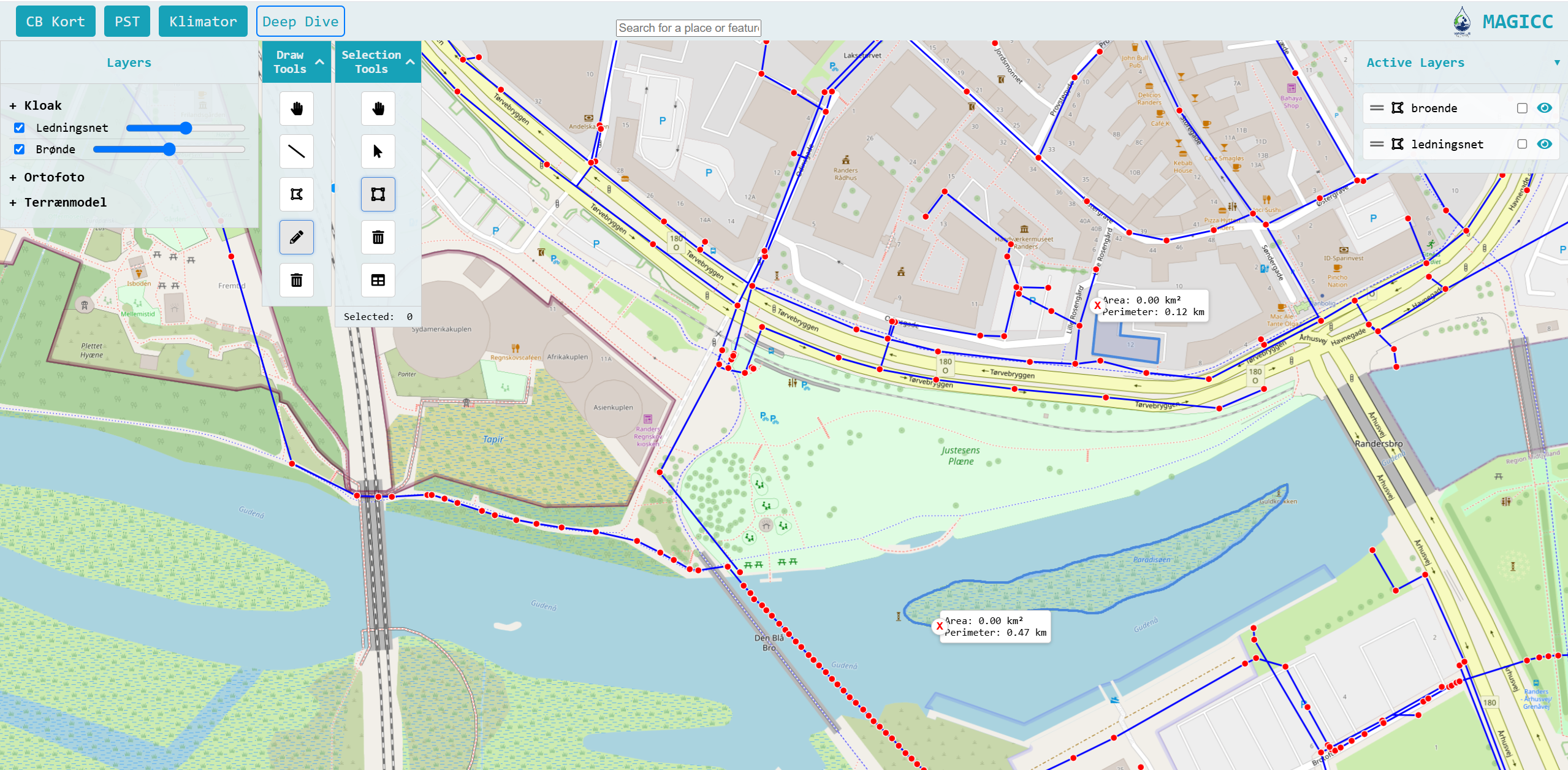
Modern Web GIS platform for geospatial analysis
Modern Web GIS platform providing comprehensive geospatial overview and analysis capabilities for environmental data management.
From civil engineering foundations to cutting-edge remote sensing applications
Leading satellite analysis for international projects including Ghana's Volta Lake Strategic Sector Project. Contributing to Denmark's Depth Model v2.0 through innovative satellite-derived bathymetry integration.
Quality assessment and management of bathymetric data using advanced geospatial processing workflows and database optimization techniques.
Conducted comprehensive river surveys using RTK GPS and sonar equipment. Developed hydraulic models for discharge capacity assessment and regulatory compliance.
Specialized in open channel hydraulics with Python-based 1D steady-state flow modeling. Research resulted in academic publication on Manning number calculations.
Contributing to scientific advancement in remote sensing and hydrographic modeling
International Hydrographic Review (IHR)
Improved compilation of bathymetric data within Danish waters using advanced satellite-derived bathymetry integration methodologies.
Read PublicationGeoForum
Exploring satellite-based solutions for shallow water mapping applications in Danish coastal environments.
Read PublicationMDPI Geosciences
Comprehensive compilation methodology for bathymetric data within Danish territorial waters and maritime zones.
Read PublicationVand & Jord
Comparative analysis of Hydraulic Radius versus Resistance Radius in Manning number calculations for open channel flow.
Read PublicationContinuously advancing expertise through specialized coursework in AI/ML, computer science, and project management.